Frustrating Success
Brian Williams
Attempting to make a
cave connection through a sump is difficult at best, but it’s even more difficult
to find (coerce) the right cavers (anyone breathing ) to drag gear over a mile
through cave passage alternating between long swims and breakdown climbs, only
to reach the destination where they sit and freeze while waiting for the diver
to come back. The first few times you
ask for help you generally get a few enthusiastic folks, and most cavers are
always good for a trip they haven’t been on.
But try talking them into coming back, same cave, same tanks, same long
cold swim…. different day and well, let’s just say you have to wait a long time
for the sherpas to forget about the last trip before they are willing to do it
all again.
This was not the first
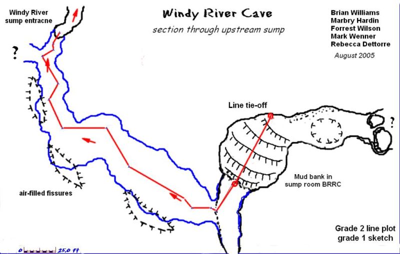
The plan for this trip
was to head upstream and try to make the connection and get the survey data
through the sump. Additionally, a new,
knotted line would need to be run through the passage to facilitate the survey. We needed two divers. One to go re-lay line
and the next to make the final push and try to get as much survey as possible,
then next to make the connection to BRRC.
That was the successful part. We
had 5 cavers to get all this gear upstream to the sump.….that was the
frustrating part.
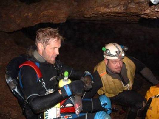
Gear for the trip
consisted of: 4 AL 30’s rigged sidemount, two harness systems, 8 lights,
2 exploration reels, 2 safety reels, 4 sets of regs, assorted back-ups, tools,
silt screws, fins, 20 lbs of weight, and all the usual personal gear including
food, water and extra polypro. This is a
lot of gear for 5 cavers to move through a mile worth of difficult passage.
Fortunately we were able
to drive the bottom of the valley which
shortened the hike but we still had a long way to the cave
entrance. The plan was for Marbry to
make the first dive and try to crack the sump.
I would make the next dive and try to get some survey. Things don’t always work out the way you have
it planned, but this is where the biggest asset of a caver comes in to
play….flexibility. Making last minute
changes and still getting the job done.
Upon unloading the gear Marbry discovered that he had forgotten his
harness. The plans quickly changed and
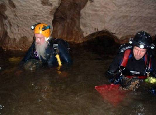
now it was down to Forrest and me for the dives. No problem, we’ll make it work.
After a couple hours of
swimming and scrambling over breakdown, we arrived at the staging area some 800
ft before the sump. This is the last dry
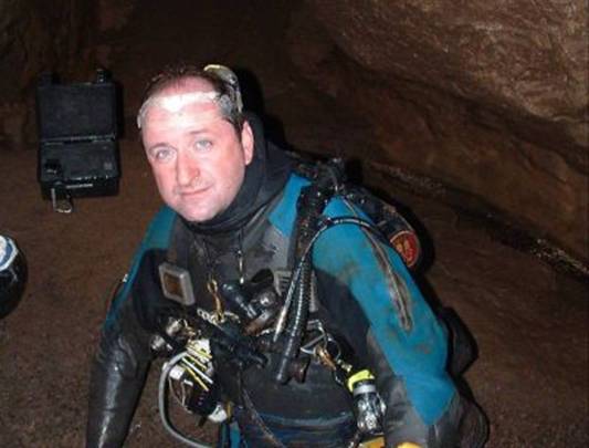
ground to gear up on and it’s all swimming after this point. I drew the lucky straw and got to dive
first. To me, every dive is a survey
dive, so I decided to lay new line and get as much survey as I could, then
Forrest could come in and continue the exploration. Marbry and Mark swam up to the terminal point
with me then headed back to the staging area as I tied off and proceeded into
the sump, running new knotted line in as I went to facilitate the survey. The passage ceiling fell away in several
places and I surfaced 3 different times in fissures approximately 40 to 50 ft
long and between 10 and 20 feet high.
After 225 ft, I left a loop on the end, turned the dive and surveyed
out. Total dive time was 45 minutes,
max depth = 19 ft. Arriving back at the
staging area I gave a quick report about the going passage and it was time for
the next diver. Tired muscles stiffen up
nicely while waiting for the returning diver and Forrest had decided not to
dive. I was still “motivated”, so we switched my rig over to the remaining 2
tanks and back I went.
This time I wanted to
make the connection if possible, so I ran straight to the end of the line, tied
off and started exploring on. TJ had
described a gradual slope where he had run out of line and after I tied in, the
passage did begin to trend upward.
Continuing on for another 55 ft., I found my way up through the
breakdown and into a large air-filled room with a huge mud bank tumbling down
to the sumps edge. I had never been in
the pit room in BRRC, but this seemed to be similar to what Marbry had
described. Caution is required in all
forms of caving but even more so when you are the only one on the other side of
a sump in unknown passage. I slowly made
my way up this muddy slope, crawling and digging steps as I went. Upon reaching the top I could see that the
room was approximately 50 to 60 ft to the ceiling, and 30 to 40 ft wide with a
bend around to large breakdown. I chose
not to go further as the mud made the conditions slightly “technical” and any
misstep would mean a long fall with a questionable outcome. After finding a protrusion to tie-off on, I
left a line arrow for a survey marker and proceeded to slip and slide my way
back down to the sump. Everything was
covered in mud and I even had to scrap my boots off before getting my fins back
on. This was going to reduce visibility
back through the sump to 0 so after I eased into the water I set a silt screw
on the bank at waters edge and made one final tie-off. Still needing to get the last of the survey,
I made my way to the first station and took a quick backsight before being
engulfed in silt. The trip back out was
uneventful and the silt cleared near the end.
Arriving back at the
staging area one hour later, we were all ready to head out by this time. We quickly repacked and began the long trip
out…..dreaming of Mexican food and Dos Equis awaiting us in McMinnville.
The
These are not your
average caving trips and could not be possible without a dedicated group of
cavers willing to make the hard trips in the name of exploration. Special thanks to The Tennessee Central Basin
Grotto, and all the cavers that have been involved with the mapping projects in
this area over the years.